|
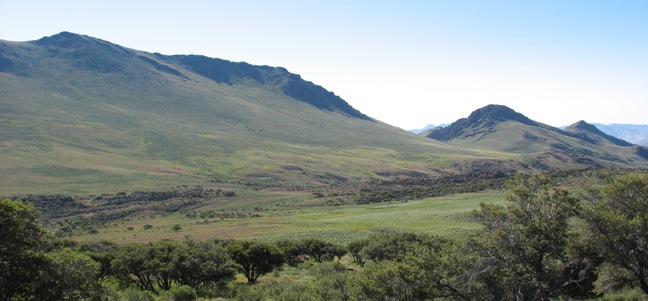
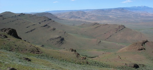
The Pueblo Mountains, lying south of Steens Mountain and rising nearly as high, is of an entirely different character. Unlike Steens Mountain, Pueblo Mountain holds no huge glaciated gorges. Instead it consist of a single main ridgeline with a few basins and outlying hills. While most vegetation consists of sagebrush and bunchgrass, wildflower displays can be superb. Compared to Steens' vigorous uplift, this is a 'Grandmother' mountain with mystery and charm all its own, not the least of which is its isolation. Situated far out in the Oregon Outback the surrounding human population is sparse. There are a few scattered ranches and occupants of the tiny hamlets of Fields and Denio. Otherwise you are alone.
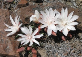 The Desert Trail, a National Scenic Trail, runs along the crest of the range. Identified not by beaten tread, but by rock cairns perched among the sagebrush and bunchgrass, this route runs from southern California to northern Oregon through high desert country. The Pueblos feature some of its best. In the west, the land drops away to the dry and barren outback. To the east, the range plunges to the ancient bed of pluvial Lake Alvord, a huge expanse of water that once stretched over sixty miles across southeast Oregon and neighboring Nevada. In all directions views last nearly forever, while at your feet the flower show can be equally wonderful. The Desert Trail, a National Scenic Trail, runs along the crest of the range. Identified not by beaten tread, but by rock cairns perched among the sagebrush and bunchgrass, this route runs from southern California to northern Oregon through high desert country. The Pueblos feature some of its best. In the west, the land drops away to the dry and barren outback. To the east, the range plunges to the ancient bed of pluvial Lake Alvord, a huge expanse of water that once stretched over sixty miles across southeast Oregon and neighboring Nevada. In all directions views last nearly forever, while at your feet the flower show can be equally wonderful.
Bighorn sheep are a common sight among the high crags. Wide Van Horn Basin and Ten Cent Meadows provide springs and welcome relief from the steep slopes. The best way to describe this land is "big, open, and wild".
|
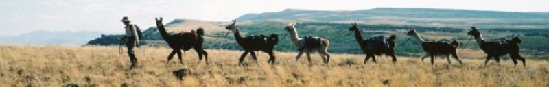
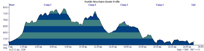
 Day one takes us from jeep roads south of Frenchglen to the mountains' crest, which we will follow south to camp in a saddle above the south fork of Willow Creek. On day two, we continue to follow the crest, picking up the Desert Trail, only to leave it behind as we swing across the western shoulder of the high point. Day three has us crossing back over the spine of the mountains to visit Van Horn Basin and camp near Ten Cent Meadows. Day four is a layover day that provides opportunities to explore on your own. Day five takes us north through Stergen Meadows to begin our up and down crossing of the eastern drainages. Day six returns us to our starting point along Sesena Creek.